
Montevideo is once again debating its metropolitan transport system. At first glance, this may seem like a technical discussion: routes, frequencies, infrastructure. But decisions about mobility are never purely technical. Over decades, they organize territory, redistribute land value, and determine who can access —and who cannot— employment, education, or urban services. In other words, every transport system produces a different city. To speak about mobility, therefore, is to speak about territory.
In an award-winning study published by the Departmental Board in 1971, architects Carlos Altezor and Hugo Baracchini warned about the uncontrolled and radial growth of Montevideo, the lack of services across large areas of the city, and the consolidation of a “shameful unhealthy belt.” They also pointed to the persistence of the structural causes that produced this scenario of a disordered city lacking effective control over its expansion.
That metropolitan belt did not disappear. On the contrary, it continued to expand. In 1974, the civic-military dictatorship approved Law 14.219, which deregulated rents and accelerated processes of residential displacement toward the periphery. Between 1963 and 1996, the population of the metropolitan area grew at the same rate as that of the country, but its territorial distribution became profoundly unequal: while consolidated urban areas lost nearly 10% of their population, the metropolitan peripheries increased their relative weight by a similar magnitude. Metropolitan expansion thus fed on the emptying of central areas.
In 1998, the Montevideo Plan (POT) attempted to address this scenario. Among its strategic guidelines, it proposed moving toward coordinated metropolitan planning and recommended the development of a sectoral mobility plan that would organize the transport system in relation to the city’s territorial structure.
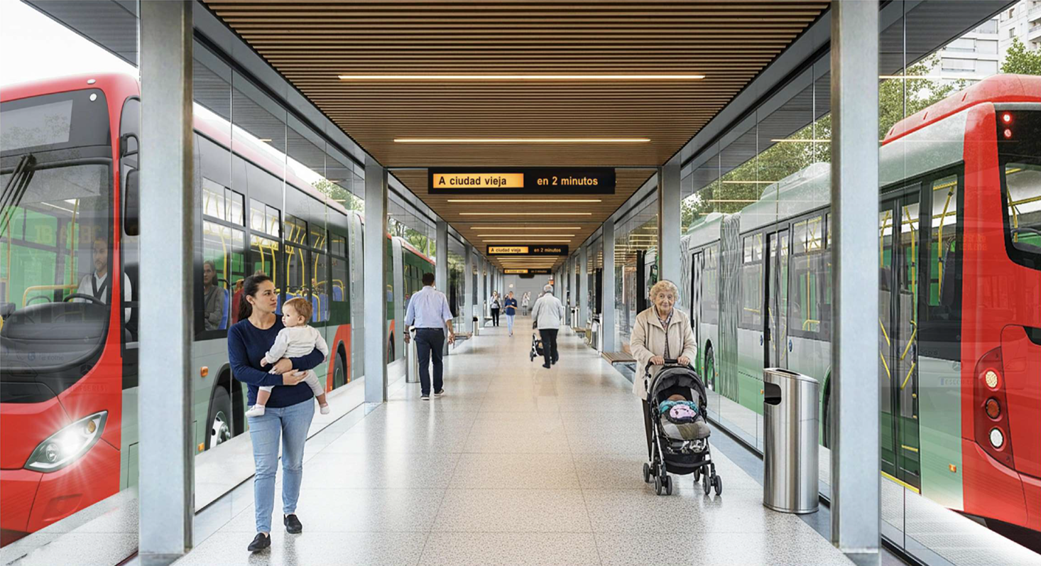
That sectoral plan was approved in 2010. It proposed a network of trunk transport corridors complemented by interchanges and terminals intended to play a revitalizing role in the territory, consolidating urban fabrics and reinforcing existing centralities. The plan had significant resources and resulted in several concrete works that, at the time, generated intense public debate. A more in-depth analysis of that experience —its achievements and its limitations— would be a valuable contribution to the current discussion.
Fifteen years later, the national government has decided to promote a new transformation of the system. The Ministry of Transport and Public Works announced the creation of an institutional framework to manage the project, the availability of significant funding, and the dissemination of various technical studies prepared by specialized consultancies.
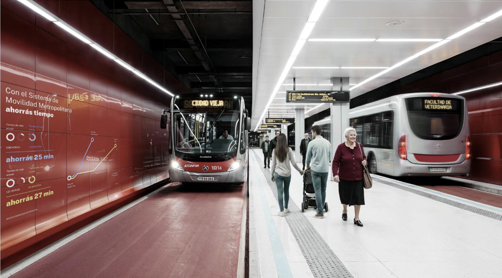
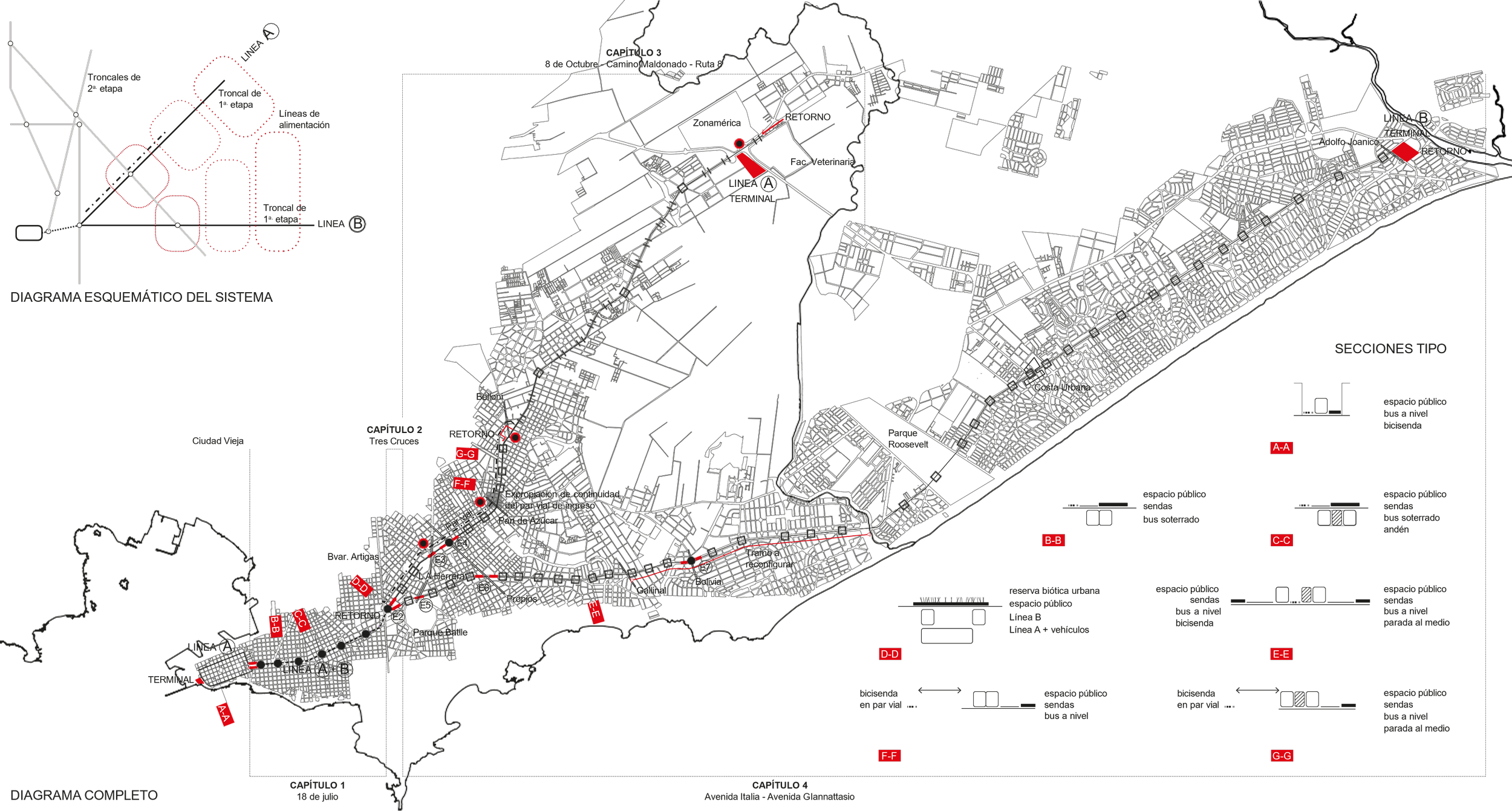
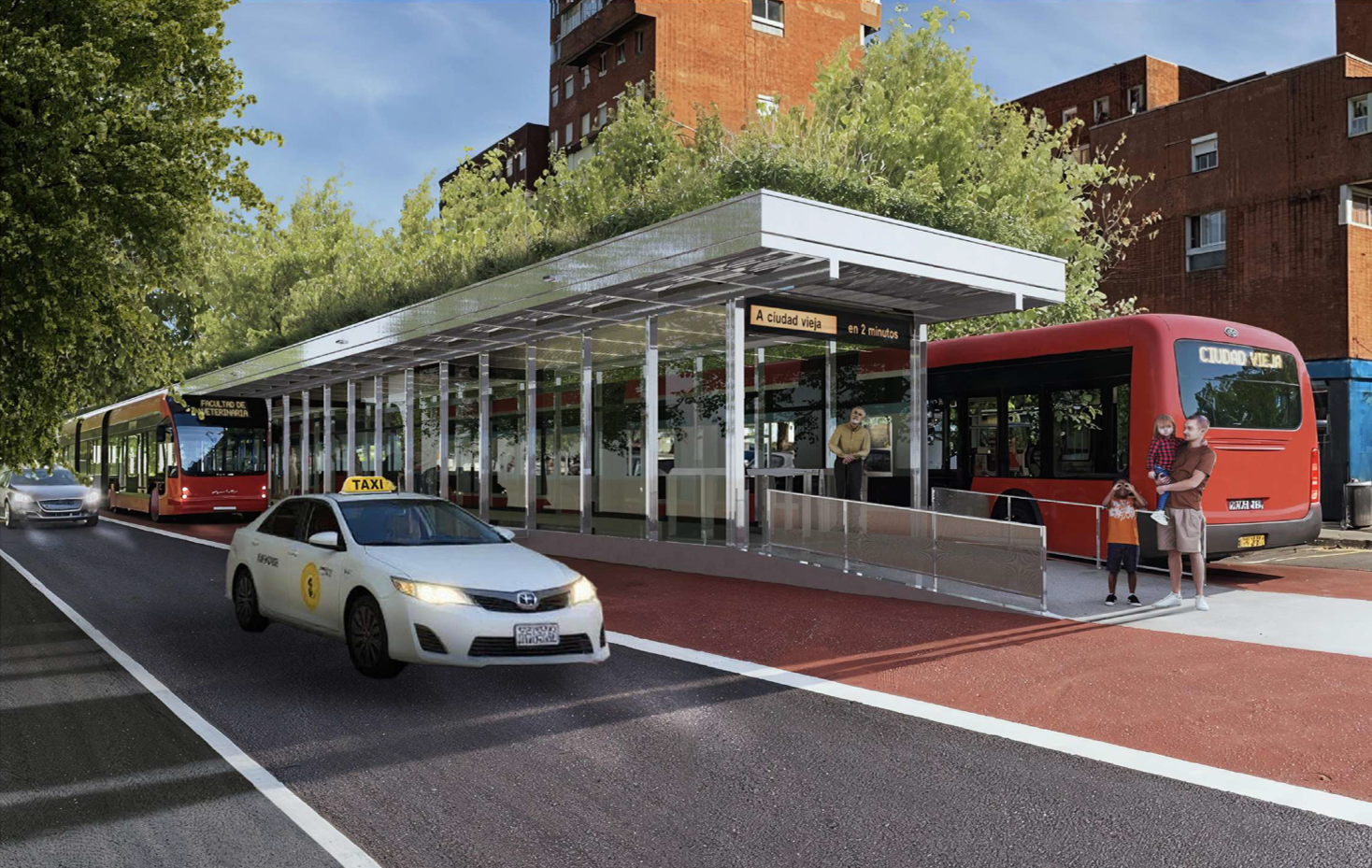
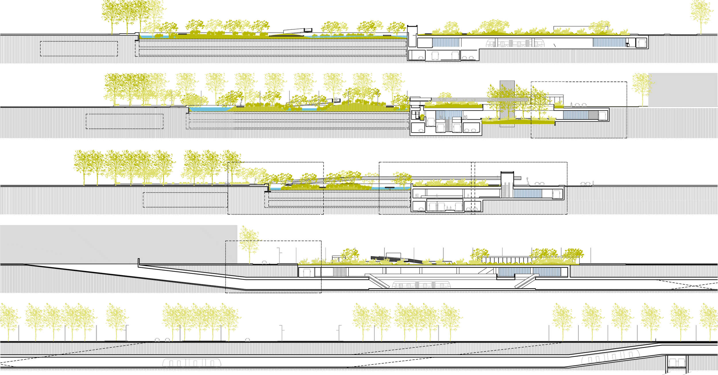
The announced project foresees the creation of two high-capacity trunk corridors: one to the east, following Avenida Italia and Giannattasio to El Pinar, and another to the northeast, following 8 de Octubre and Camino Maldonado to Zonamérica. Both corridors would converge at a major interchange around Tres Cruces and connect with a central axis crossing the city center to Plaza Independencia.
This is, without doubt, a large-scale intervention capable of significantly shaping metropolitan mobility. But transport does not only move people; it also distributes opportunities. Access to employment, education, healthcare, and culture largely depends on travel times within the city. When a neighborhood is ninety minutes away from the main employment centers, inequality ceases to be merely economic and becomes territorial as well.
When data on job location, travel times, dependence on public transport, and income distribution are cross-referenced, a fairly clear pattern emerges. Areas with the greatest accessibility difficulties are concentrated in the north and west of the metropolitan area, and partly in the northeast. By contrast, the main employment hubs are located along the city’s central–eastern axis: the Tres Cruces and Cordón area, Pocitos and the World Trade Center, Zonamérica, the airport, and the Route 101 logistics corridor.
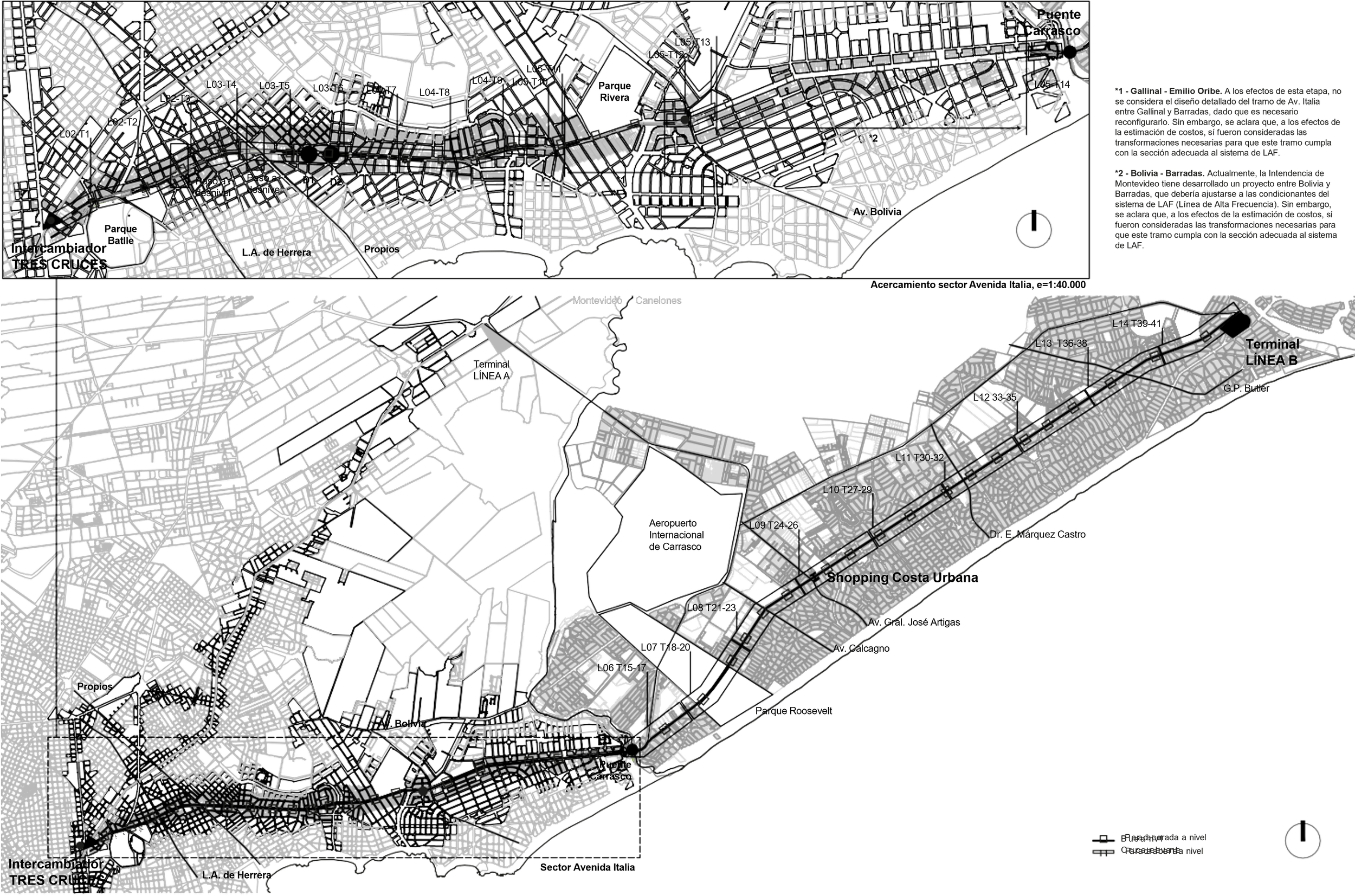
Neighborhoods such as Casavalle, Piedras Blancas, Manga, Cerro, Casabó, or Santa Catalina share a strong dependence on public transport and long daily commutes to areas with higher concentrations of employment. If territorial equity were the central planning criterion, the priority corridors would likely be different.
The project currently under discussion prioritizes the Avenida Italia–Giannattasio and 8 de Octubre–Camino Maldonado axes. These are important corridors, but also territories that already have relatively high service levels and display strong economic dynamism. To the east, Ciudad de la Costa has concentrated much of the residential expansion of the middle classes and still retains large reserves of developable land. To the northeast, the business and logistics corridor linked to Zonamérica, the airport, and Route 101 continues to consolidate.
Improving connectivity in these territories naturally increases their attractiveness for investment. The problem arises when this criterion becomes the only criterion. If territories with the greatest accessibility difficulties —the metropolitan north, the west of Montevideo, and other peripheral neighborhoods— are left out of initial priorities, the discussion ceases to be purely technical. Transport infrastructures do not merely respond to existing mobility patterns; they also organize the land market and steer future urban development.
At its core, this debate confronts two cities moving simultaneously. An emerging corporate city stretching between the World Trade Center, Buceo, Carrasco, and Zonamérica. And a working city, deeply rooted in history, occupying much of the metropolitan north, the west of Montevideo, and various peripheral neighborhoods. From this perspective, the challenge of metropolitan mobility is how to connect both cities in a fair and efficient way.
The metropolitan area is now an undeniable territorial reality, yet it still lacks full political and institutional recognition. Metropolitan territories have no formal existence in our legislation, and any policy that transcends departmental boundaries requires constructing that scale of governance.
What metropolitan project do we want to build?
Large transport infrastructures are not merely engineering works. They are decisions that organize territory for decades. They determine which areas are better connected, where investments concentrate, and which opportunities are closer to or further from different sectors of the population. For this reason, before defining corridors, tunnels, or major works, it may be worth pausing to pose some basic questions.
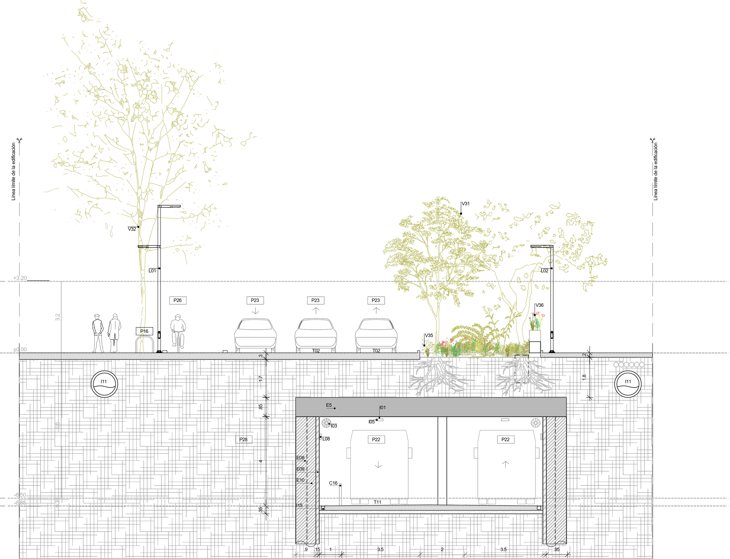
Does burying infrastructure really improve the city? Is it worth the cost compared to other possible investments that could improve the system as a whole? What scale should a metropolitan transport intervention have: solving a specific problem, or reorganizing accessibility across the entire metropolis?
The answers are not simple, but they are an essential condition for defining a plan capable of projecting the city into the next fifty years. It is evident that any sectoral project of a territorial nature must form part of a broader plan: part of a policy, a territory, a history, and a project of city. When it comes to major transformations and large investments of social labor, understanding inherited territories is as important as imagining possible futures.
For fifty years, Montevideo has not clearly defined what kind of metropolis it wants to build. It would be reasonable that, before deciding in just a few months on an infrastructure that will shape the coming decades, that discussion finally takes place.
The metropolitan area is already saturated with fragments and estrangements.
Image credits: All images courtesy of Metropolitan Mobility Project by Faculty of Architecture of the University of the Republic of Uruguay
Author: Juan Pedro Urruzola – Gustavo Vera Ocampo